Taiwan Security Monitor

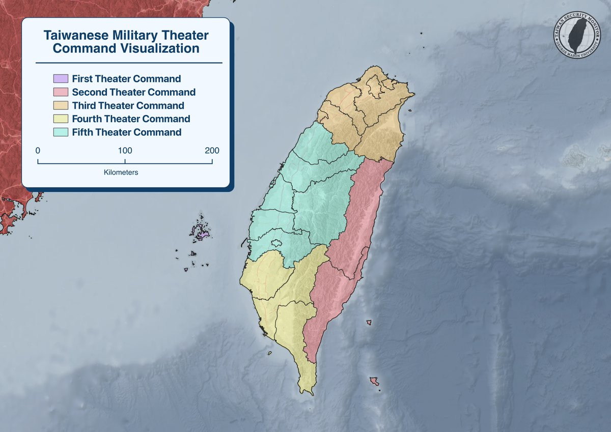
Visualization: Taiwan Military Theatre Command

Authors: Chris Dayton, Noah Reed


In 2021, Taiwan’s military reorganized its command structure into several “operational zones” (ไฝœๆˆฐๅ€), also often called “operational theaters” . These zones represent the integrated command of Taiwan’s different armed services.

Recently, Taiwan’s MND announced each command will have an integrated UAV battalion by 2026. Our visualization shows the breakdown of each command’s territorial jurisdiction.
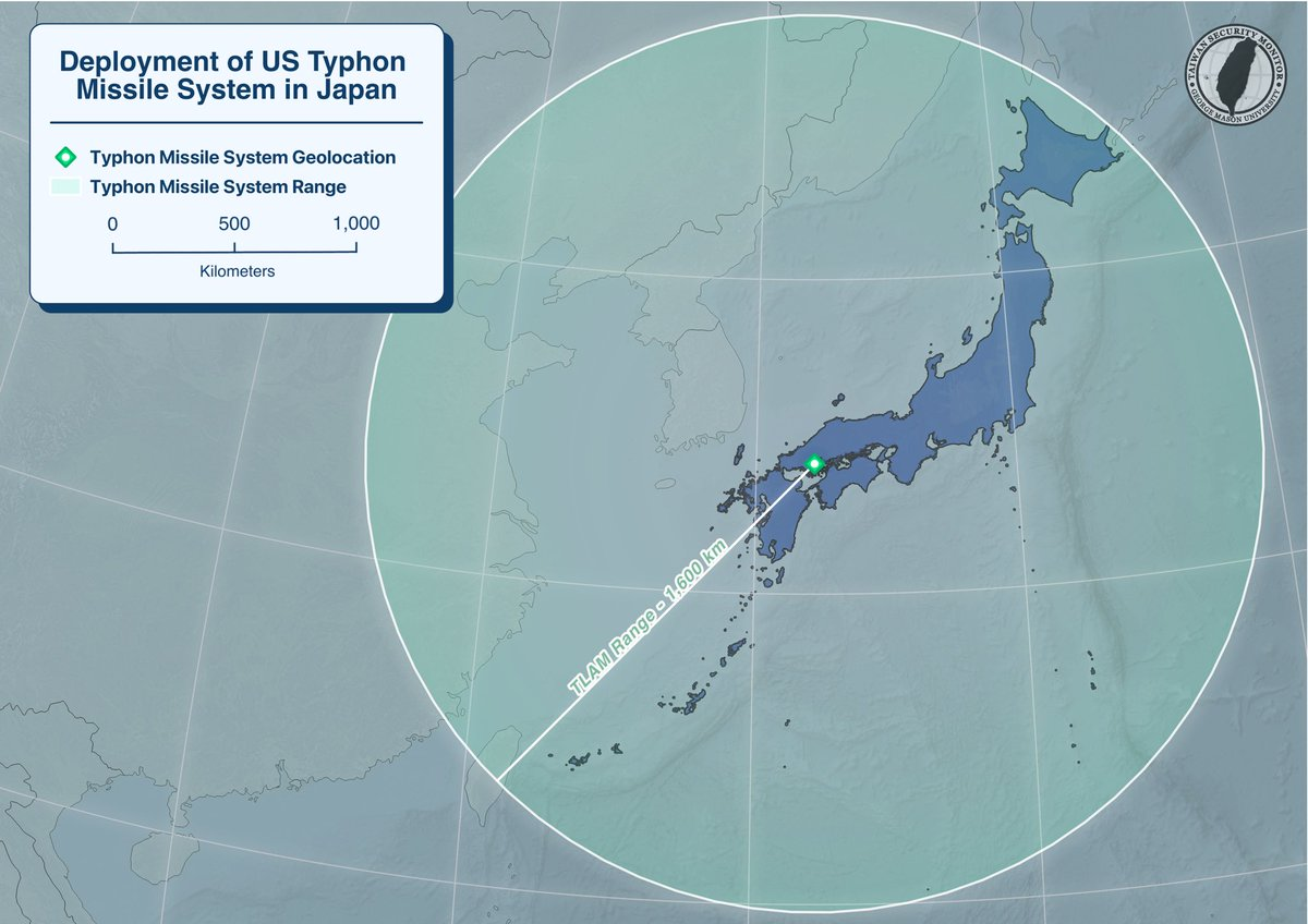
Visualization: Deployment of U.S. Typhon Missile System in Japan

Authors: Chris Dayton, Joe O’Connor


On September 15, a U.S. Typhon Missile System, capable of firing the Tomahawk Land Attack Missile (TLAM), was deployed to Marine Corps Air Station Iwakuni in southern Japan. This marks the first deployment of Typhon to Japan, and the platform will take part in the currently ongoing Resolute Dragon 25 exercise.

Below is our visualization of the Typhonโ€™s deployment location and operational range.

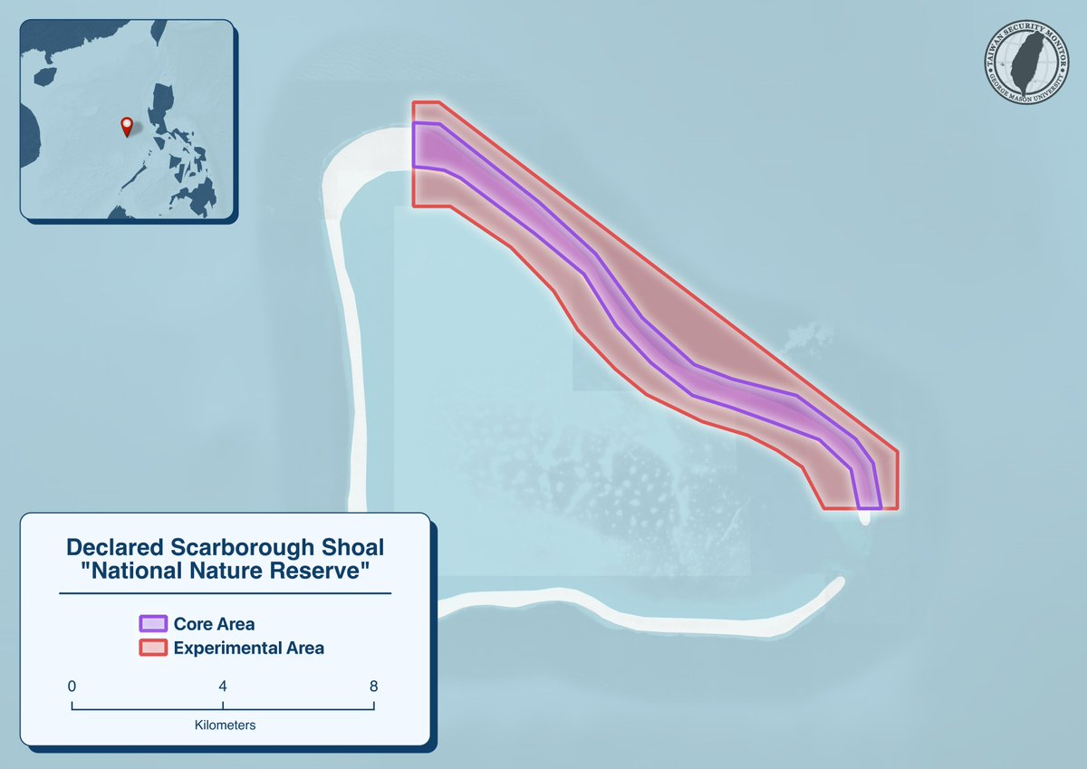
Visualization: Delared Scarborough Shoal “Natural Nature Reserve”

Author: Chris Dayton


Following an incident on August 11th between a PLAN/CCG vessel and a Philippine Coast Guard vessel near Scarborough Shoal, the PRC recently announced the creation of a “national nature reserve” surrounding a portion of the Shoal.

Our visualization shows the core and experimental areas, which respectively limit certain activities within their areas.

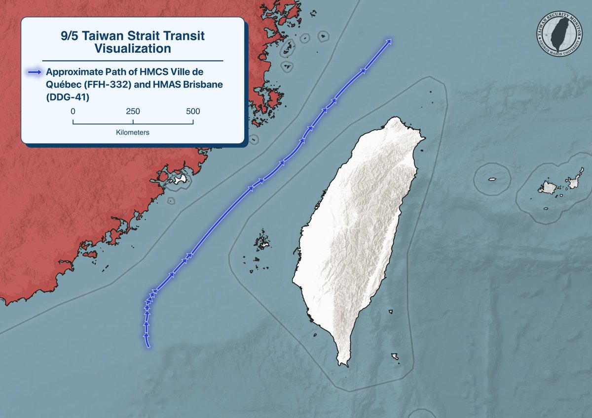
Visualization: 9/5/25 Taiwan Strait Transit

Authors: Joe O’Connor, Chris Dayton


Our visualization of the northbound Taiwan Strait transit undertaken on 9/5 by HMCS Ville de Quรฉbec (FFH-332) and HMAS Brisbane (DDG-41). Track is approximate, based on Marine Traffic AIS data & public reporting.

Visualization: New Type-12 and HVGP Missile Deployment Locations

Author: Chris Dayton

Research: Ethan Connell


On August 29, Japan’s Ministry of Defense announced the deployment locations of improved Type 12 surface-to-ship missiles, as well as their Hyper Velocity Glide Projectiles (HVGP). Below is a TSM map showcasing those locations and the maximum range of those missiles.

Visualization: Map of Scarborough Shoal Collision and Nearby Naval Activity

Authors: Chris Dayton, Ethan Connell


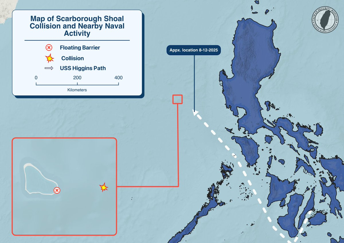
On August 11, 2025, a PLAN destroyer and a China Coast Guard cutter collided with each other in the waters around Scarborough Shoal during a close-quarters pursuit of a Philippine government vessel.

Above is a visualization highlighting the reported collision site and the floating barrier at the shoal, along with USS Higginsโ€™ approximate 8/12/2025 position and estimated track derived from public AIS data.

Visualization: Han Kuang 41 Major Exercise Location Heat Map

Author: Chris Dayton


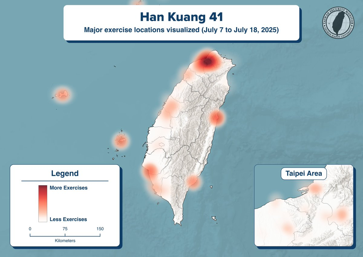
Where did Taiwan’s military place the greatest emphasis during 2025’s Han Kuang exercise? TSM created a heatmap to find out! It highlights the distribution and relative frequency of major exercises that occurred across Taiwan, including the outlying islands and Penghu.

Visualization: Han Kuang 41 Major Exercise Locations

Author: Chris Dayton


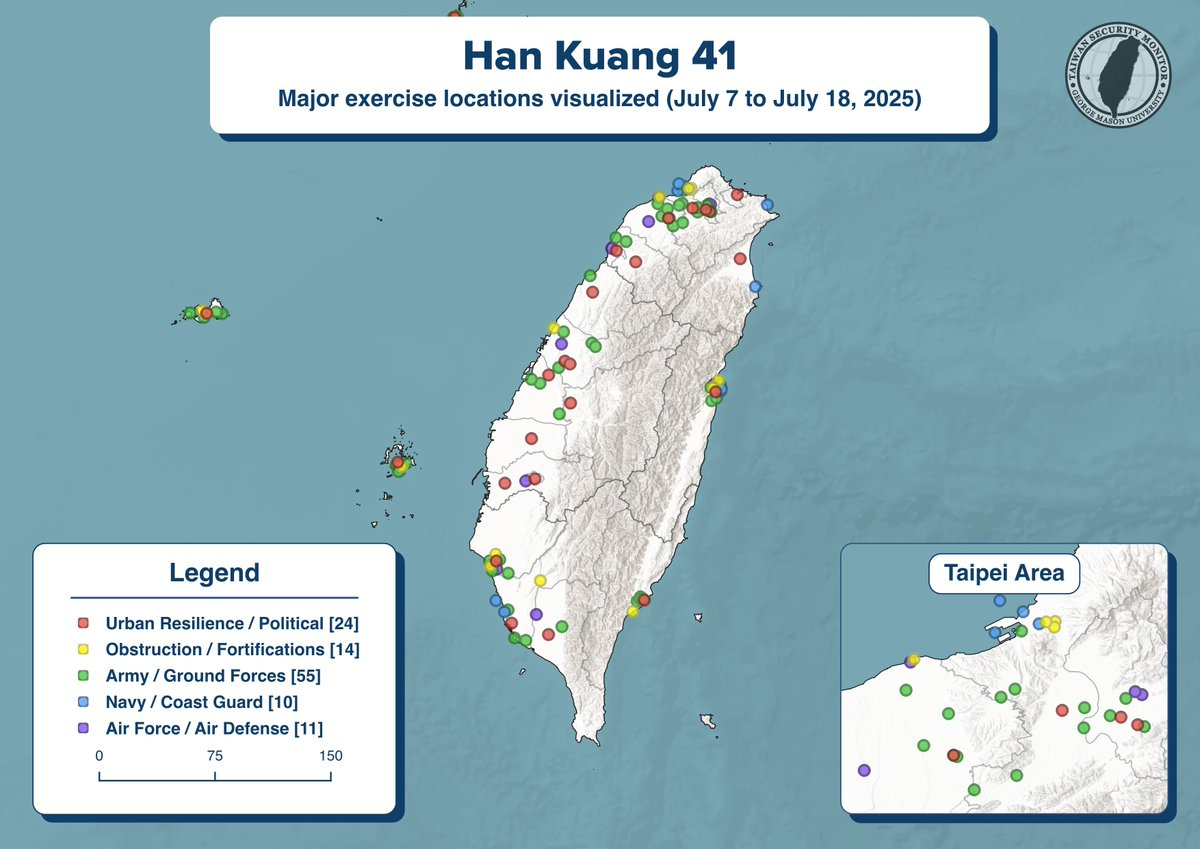
Above is TSM’s poster breaking down Han Kuang 41! It contains the location and category of major exercises that occurred all over Taiwan, including the outlying islands and Penghu. We’ve mapped every disclosed and geolocated exercise, starting from mobilizations on the 7th.

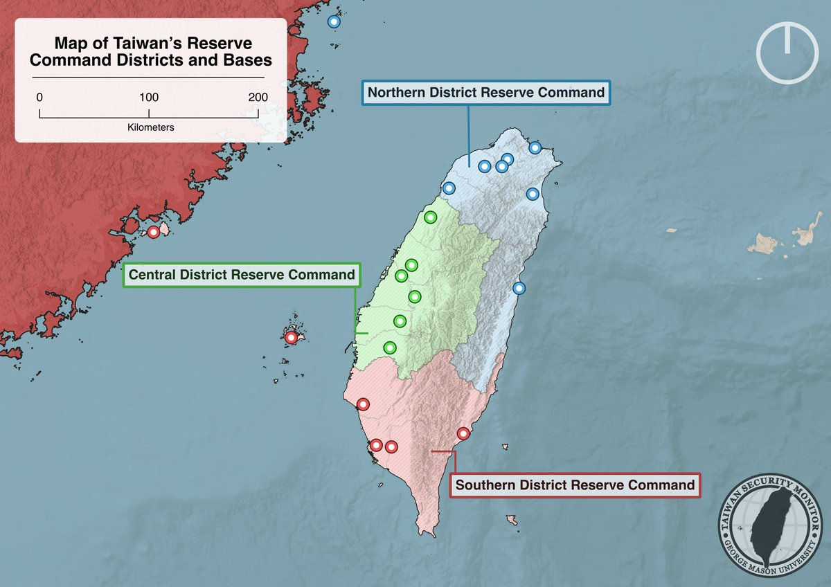
Visualization: Map of Taiwan’s Reserve Command Districts and Bases

Author: Chris Dayton


Above is a map of Taiwan’s Reserve Command Districts and Bases, created in anticipation of HK 41 exercises.

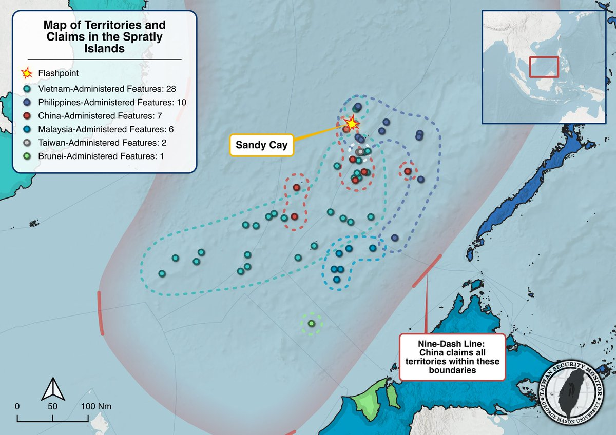
Visualization: Map of Territories and Claims in the Spratly Islands

Authors: Chris Dayton, Ethan Connell


The PLAโ€™s Southern Theater Command recently undertook live-fire exercises to the north of the Spratly Islands, which they claim under their Nine-Dash Line.

Above is our visualization of the administration of those features along with Chinaโ€™s claims, highlighting a May 21st incident in which a China Coast Guard ship sideswiped and water-cannoned a Philippine government vessel in the waters around Sandy Cay.